In 2014, work was completed on the establishment of the Nordic Walking Park "Przysucha". It is one of 6 such parks designated within the operational area of the Razem dla Radomki Association. In the area of the Nordic Walking Park "Przysucha," three trails differing in difficulty level were created. All three trails run through beautiful forests of the Przysucha Forest District.
The Nordic Walking Park is gaining increasing popularity, with the number of people using the designated routes steadily rising. Even before the described loops were marked, the place was very popular among walkers, runners, and cyclists. Clean air, peace, the beautiful scenery of the Przysucha forests, the richness of plant and animal species, as well as tourist and recreational infrastructure – all this makes the Przysucha Forest District an ideal place for relaxation.
 First green trail
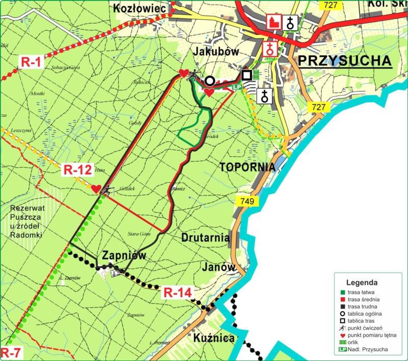
 (length 6 km, estimated walking time 60 minutes) starts at the Orlik 2012 sports facilities in Przysucha. There is a board at this location with exercises useful for warming up. Starting the walk on the green trail, we enter Targowa Street and after walking a few hundred meters, we pass the office of the Przysucha Forest District. Then, along the newly renovated asphalt road by the Forest District, we enter the forest. Upon reaching the forest parking lot, we continue along this road and after a few minutes reach the tourist site “Skałki” equipped with tables, benches, and a campfire area. This site is essentially a 15-meter sandstone wall. The place is very popular among the local community. From this point, the green trail runs entirely along forest paths and roads, overlapping with the “Rawicz” nature trail established in 2004 by the Przysucha Forest District. Boards placed along the trail present the richness of nature, interesting facts about forest life, and information about the historical past of this region. After traveling several kilometers through the forest, we reach Targowa Street again and return to Orlik, ending our hike there. The difficulty level of this trail is rated as easy, so mainly it is intended for beginners.
 Second red trail
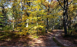
 (length 10.80 km and estimated walking time 120 minutes) is intended for both beginner hikers as well as the more advanced. The beginning of the trail partially overlaps with the green trail. In this route, we pass the “Skałki” tourist site on the left and continue according to the markings found on-site. Most of the trail runs along an asphalt road; walking along it, we reach the highest point on the route, a forest observation tower located at an altitude of 350 m above sea level, and after an additional 400 meters, we reach an exercise board and a heart rate measuring point. After checking the heart rate and performing some exercises, we turn left. At this point, the red and black trails split. Walking along a dirt road for several hundred meters, we reach a point where the red trail meets the black trail again. From there, the return towards Przysucha begins. On this section, the trail overlaps with the “Rawicz” educational trail, on which numerous information boards are located. The history of the surrounding forests is also the history of the metallurgical industry, which developed in this area in the 18th and 19th centuries. Remnants of this activity are several “hills” scattered along the route, known as “ore pits.” These served as mining shafts in the past. During the further walk, we pass, among others, stop 18 on the educational trail – the “Rawicz” forester’s lodge. There was an old wooden forester’s lodge there, which during World War II was burned down by German soldiers. The destruction of the lodge was a consequence of tragic events in 1943, when 12 partisans quartered there were killed by German gendarmes. This event was commemorated by placing a memorial plaque in 1993. Heading towards the town, we pass, among others, a mid-forest swamp and a memorial cross for a village that no longer exists. We exit the forest slightly below the forest parking level and, walking downhill along the asphalt, reach the starting point at Orlik 2012.
 Third black trail
 (length is 14.70 km, estimated walking time is about 180 minutes). The longest of the trails making up the Nordic Walking Park Przysucha, marked in black. The trail, like the previous two, starts at the Orlik 2012 sports facilities. Walking according to the trail markings southward, after covering 6.4 km, we turn left. Along the black trail, we pass the inactive “Zapniów” clay mine and then turn left again. After another few hundred meters, the black trail merges with the red trail and shortly after we enter the “Rawicz” educational trail. Following the black trail, we pass Grodzka Góra. According to conducted research, in the 7th century AD, this elevation was probably the location of a solar sanctuary (detailed information is placed on a specially prepared board). Walking towards the “Skałki” site, we reach the junction of all three trails – the asphalt road, which, when taken downhill, leads to the starting point. The black trail is intended for people with good physical condition.
 Fourth Dwór Zbożenna trail
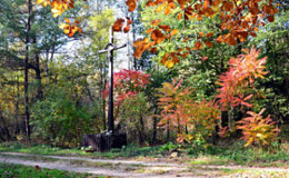
 (length is 4.20 km, estimated walking time is about 40 minutes). From Dwór Zbożenna, we head to the main road (DK 12), then west towards Przysucha. We move along the road on a wide sidewalk. After about one kilometer, we turn right. We walk to the end of this rarely used road and turn right. We continue straight all the time until the intersection, where we turn right again. After about 200 meters, we are opposite Dwór Zbożenna.
This route may not have many aesthetic values, but it is close to Dwór Zbożenna and allows practicing Nordic Walking without the need to drive by car.
There are also many field and forest paths around Dwór, but they may be difficult to pass under changing weather conditions.
source: http://www.przysucha.radom.lasy.gov.pl